Edgeward turns the ATAK ecosystem into a drone orchestration platform. Operators draw zones and points of interest on the map they already use. The software watches for other aircraft along the way and reports back through the same map. Mission planning is in development.
Operator-driven. Hardware-agnostic. Built on open standards.
Modern small units carry drones and they carry ATAK. The gap nobody has cleanly filled is the software in between — the layer that turns operator intent on a tactical map into autonomous ISR missions, and turns drone footage into actionable intelligence the operator can trust.
Edgeward is that layer. Operators draw a zone, mark a point of interest, or request an orbit. Edgeward runs perception against the feed and reports back through the same map; mission planning is in development.
Real-time person and vehicle detection and tracking on edge hardware, with ground-target geolocation. Flight-validated on real hardware.
Detects and tracks nearby aircraft from a single monocular camera. Bearings-only tracking, adapted from published naval and aviation collision-avoidance research, estimates time-to-closest-approach without needing LiDAR or absolute range. Runs entirely onboard the aircraft -- unlike systems that depend on a live link back to a ground station for avoidance decisions.
Bidirectional Cursor-on-Target. Operators draw zones and points of interest on the map they already use; Edgeward ingests them as live behavior policy and publishes alerts and proposed missions back.
Planned: generates orbit, lawnmower, and patrol routes from operator intent, for review and approval before execution. Currently in development — not yet flight-validated.
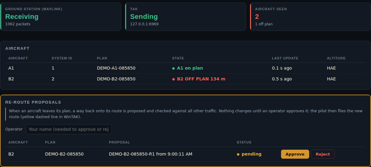
Edgeward's 4D deconfliction tool checks each flight plan against every other plan, no-fly volumes, weather and radio-frequency needs, and proposes the least disruptive fix. Positions come from the ground station the pilot already uses, so nothing is added to the aircraft. Results appear as 4D blocks and live tracks on WinTAK, using standard Cursor-on-Target.
Persistent overwatch of FOB approaches and access points.
Energy, port, and data centre perimeter monitoring with autonomous re-tasking.
Operator-defined search areas and person detection reported through the map. Planned: hotspot detection and coordination with other platforms.
Pattern-based area searches, geotagged subject location, drone-assisted extraction coordination via existing C2 systems.
Edgeward is built to integrate onto existing drone platforms as a software layer, not to replace them. We're actively exploring partnerships with drone manufacturers, hardware integrators, and defence and public-safety system providers — including through Canada's Defence Drone Initiative.
If you're building something this could plug into, we'd like to hear from you.
Start a conversation →